Claims Management System (CMS)
End-to-end digital claims management
GreenTriangle digital claims adjustment provides a seamless and automated process between insurers, loss adjusters, and farmers for more reliable and cost efficient claims adjustment
Optimize costs and accuracy
Reduce costs and increase reliability in the loss adjustment process using our machine learning and remote sensing technology
Real time access to data
Use our mobile app to collect field level data in a systematic way and access your portfolio’s field level data in real-time from anywhere via our web app
Manage moral hazard & fraud
Protect yourself from fraud, document cases when no one can be there in person, and avoid court cases by providing data from remote sensing imagery
Operate anywhere, anytime
Support customers globally with our high quality data on weather and crop conditions world wide
How does it works?
One platform for all
From farmer, to loss adjuster, to insurer, we offer a complete platform for end-to-end claims reporting and management for easy collaboration
Agriculture insurers and reinsurers
Insurers use our platform to reduce their administrative and operating costs as well as to protect from moral hazard and fraud cases. It allows them to increase their underwriting profit.
Reinsurers support the use of our platform to reduce loss adjustment expenses and combined loss ratio
Loss adjusters
Loss adjusters use our mobile and web app to capture claims without any paper work or complex mapping exercises. The necessary information is available at their fingertips on our mobile app. Also to reduce office work because reports are generated automatically and instead focus on the core business of assessing crop condition and measuring crop yield on the field
Farmers
Our platform helps to build trust across the whole risk management value chain by reducing the asymmetry of information. Satellite imagery and correctly documented claims enable all parties to align on the amount of damage and risk involved
22%
Fewer samples
necessary samples thanks to remote peril identification
27%
reduced LAE
loss adjustment costs as a result of better planned sampling campaigns
5%
improved CR
combined loss ratio due to better moral hazard and fraud control
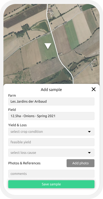
Claims reporting
Digital and instant claims reporting via your smart phone
Collect samples locally and share your insights globally with the right people via GreenTriangle’s simple mobile and web app designed to make the loss adjustment process frictionless and reliable
- Optimize crop cut locations with satellite data
- Verify a claim origin
- Fight fraud
Remote sensing
Increase accuracy and reduce costs in the loss adjustment process
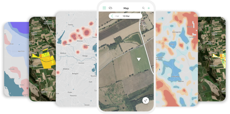
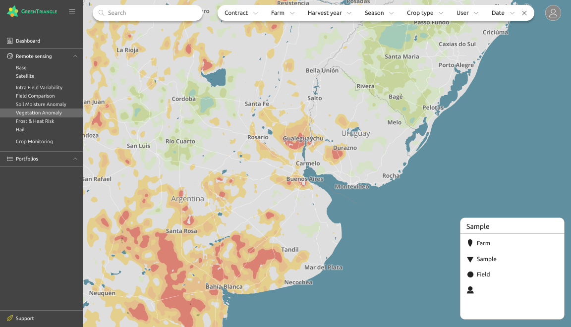
With our mobile app you have state of the art remote sensing technology at your fingertips. Plan your field visits ahead and detect fraudulent claims to reduce costs and improve auditability of your portfolio
Remote sensing maps on your phone and the web app
Satellite imagery
Intra field variability
Field comparison
Soil moisture anomaly
Frost & heat risk
Hail
Portfolio management
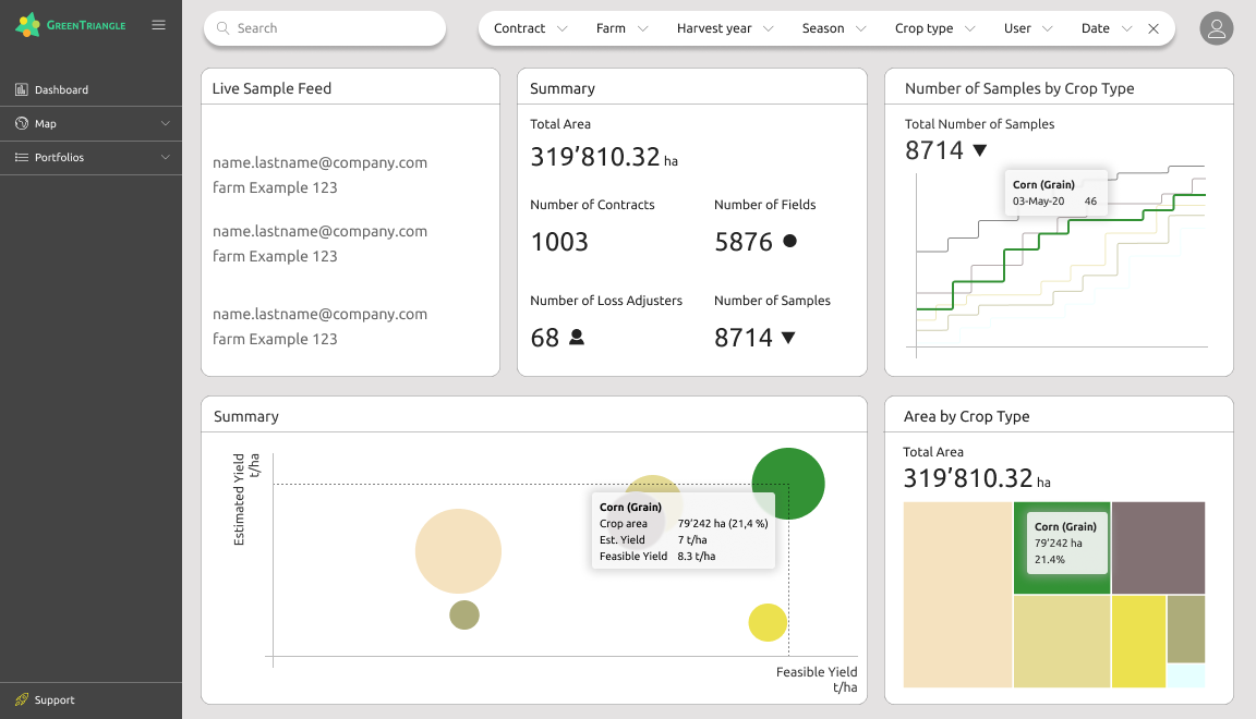
Real-time analytics and secure access to manage your portfolio from anywhere
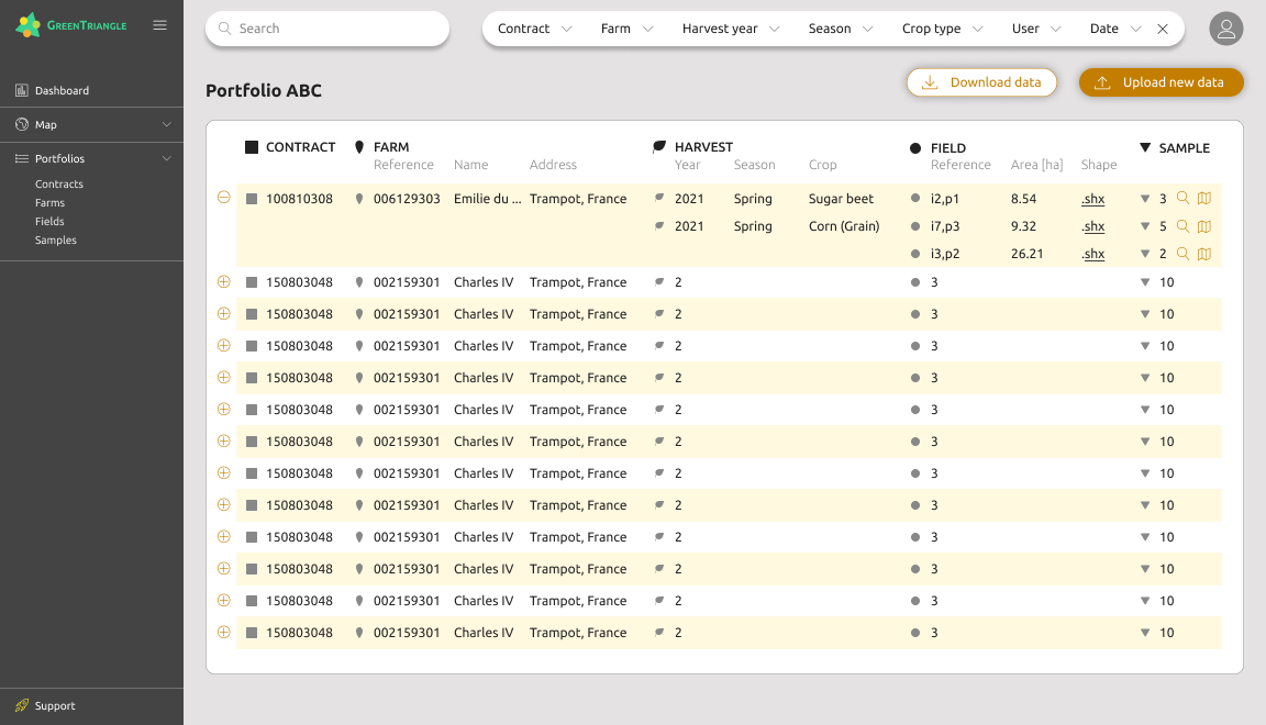
GreenTriangle web app is the fastest, most secure, and reliable way to manage your portfolios. Get field level data instantly from around the world and monitor performance of your different portfolios and regions
- Real-time data synchronisation
- Bulk upload your shape files
- Automatically generate portfolio reports
- User based account access
Any more questions? Get in touch.
Start tracking your portfolios and claims via the GreenTriangle platform or set up a pilot project. Contact us to get started.